Showing posts with label National Park. Show all posts

Thursday, December 6, 2012

Carlsbad Caverns National Park

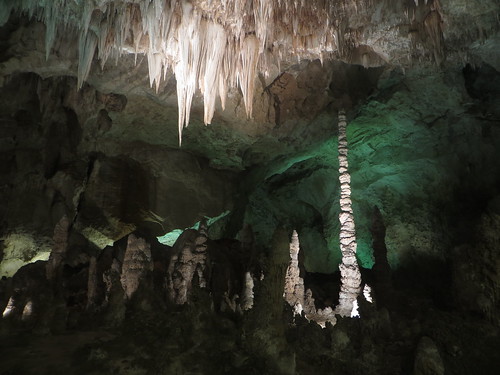
Another National Park day, this time just a day trip to Carlsbad Caverns. In the caverns there are a few options for which caves to explore, including self guided and ranger guided trips. I decided to go down the Natural Entrance and then explore the Big Cave, which are both self-guided trips. That covers more than 90% of the actual caverns, so I didn't miss much by skipping out on the ranger guided trips.

The first thing I was impressed by was the sheer scale of the caverns. In the Natural Entrance, you start going down a steep path, and then you just keep going down further and further. Looking up in the caverns gives you a feel for the scale of the caves, but they are gigantic.

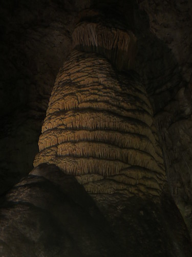
Then you start factoring in all of the 'decorations' of the caves, which are the stone structures that have been created over thousands of years. A lot of them are pretty plain, but some are actually quite intricate, with all sorts of ripples, folds, and coloring. The whole cave is lit by electric lights, but in an appropriate way. The lighting lends a feel of being in a cathedral, and everyone tended to talk in whispers.

Probably my best pictures:
IMG_2211IMG_2232

See the rest of my Carlsbad pictures here.

Wednesday, December 5, 2012

Guadalupe Mountains National Park

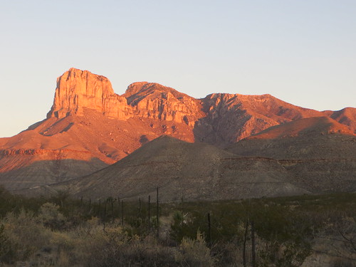
I just spent the last three days exploring Guadalupe Mountains National Park, finally spending a night in one of the parks. They allow free backcountry camping, so I left my bike at the visitor center and took off for two nights to go backpacking for a bit. The only catch is that there are no water sources in the backcountry, so I had to carry all of my water with me. I had already been doing that on the bike, so I had enough capacity, but it was still pretty heavy. Good thing I'm in good shape from previous backpacking and now all the biking.
IMG_2086
I left the visitor center in the afternoon and hiked about 4 miles up 2000 feet to a campsite called Pine Top for the first night. Thankfully there were a bunch of trees in the area, because it was pretty windy all day long. Camping in a bunch of trees is definitely a nice change from what I have been doing. Also, getting away from any traffic noises was a nice reward for the steep climb up.

The second day I went for a day-hike from my camp, on a loop called The Bowl, which is basically a big depression on the top of the mountains, which has been home to a Ponderosa Pine forest. There was some fire damage from a forest fire in 1990, but the forest has regrown quite a bit since then.

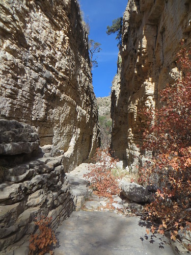
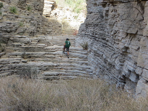
The last day I hiked back down to the visitor center, then went on a day hike from the visitor center to a place called Devils Hall, which is a natural stone staircase at the bottom of a steep canyon with nearly vertical walls.
IMG_2112
IMG_2116

See the rest of my Guadalupe pictures here.

Thursday, November 22, 2012

Saguaro National Park

I'm not quite sure what I was expecting for Saguaro National Park, but this wasn't really it. I visited the eastern portion of Saguaro National Park, which is right on the border of Tuscon, AZ. Essentially this visit consisted of an 8 mile loop road that went through a bunch of desert terrain. It was pretty cool to be zooming downhill past a bunch of really sharp plants on either side.

The actual "saguaro" forest has been coming and going since the creation of the park. Apparently a variety of environmental factors have caused a lot of them to die off, creating much less of a forest appearance. Then, restrictions on grazing rights in the park have caused an increase in the number of new saguaro plants growing, so we'll have to wait and see if the forest can recover.

See the pictures:
http://www.flickr.com/photos/61247038@N02/sets/72157632090894504/


Sunday, October 21, 2012

Yosemite National Park

Today was another National Park day. I spent the first half of the day just getting into the park, coming from the small town of Fish Camp, roughly 35 miles from the main valley. Several good climbs along the way, and pretty cold temperatures. It was supposed to be roughly 15-20 degrees tonight, with rain/snow the next day.

I decided to skip the side trips to some sequoias, since I have already seen a bunch, and spend more time in the valley. There are several large rock formations along the valley, and usually some good waterfalls as well. Unfortunately it was very dry, so a lot of the waterfalls either weren't flowing, or were considerably diminished from their spring grandeur.

The diminished water levels actually made one of the waterfalls even better though. There was a small waterfall that is known for being blown around by the wind on the way to its bottom. Since there was a lot less water flowing through it, the waterfall didn't actually even get down to the bottom before the wind dispersed it. It was cool to see a waterfall that kept changing back and forth as the wind gusted.

Another water feature was Mirror Lake, but it was entirely dry. Otherwise it is supposed to have a nice reflection of Half Dome, one of the most prominent rock formations. One side of the park is actually closed to vehicles, so I was able to ride around on my bike with just a bunch of pedestrians and other bikers on rental bikes.

On the way out of the park I met two Swiss touring bikers, who were headed into the park and then towards Las Vegas. They didn't realize the weather conditions that were coming up, since they were going over a 10,000+ foot pass on the day of rain and snow. They were still going for it after I mentioned this, but a little bit more cautiously.

http://www.flickr.com/photos/61247038@N02/sets/72157631837695918/

Thursday, September 20, 2012

Canyonlands National Park

Today I got to the Canyonlands Visitor Center right in time for sunrise. The sun rose just over the La Sal mountain range, with an interesting tint due to the smoke in the air. The smoke is from a large fire north of here, it's not enough to smell like smoke, but it does obscure the views from farther off.

After the sunrise I went to the Mesa Arch, which is supposed to be a nice short hike to another arch. The really cool thing about Mesa Arch is that it stands on the very edge of a cliff, so looking through the arch you can see an awesome backdrop. It would have been a good spot for sunrise, but by the time I got there it was a bit later, so a lot of the features were a bit ghostly. This made for a few really cool photos too.

After that I went to a bunch of different overlooks, and a few side hikes to different points. Along with a bunch of views off the edge of cliffs I also visited one spot that was a large collapsed dome area. This area is supposed to be either an old salt dome that burst and eroded, or the site of a meteoroid hit that burst the area and the subsequently eroded away to blast junk.

http://www.flickr.com/photos/61247038@N02/sets/72157631685519221/

Tuesday, September 18, 2012

Arches National Park

Today I spent the entire day touring Arches National Park. I had camped two or three miles from the entrance so I got there early in the day and was able to devote the entire day to the park.

There was a pretty good climb just to get up from the entrance, and then several other good climbs throughout the day as well. The main route was 36 miles round trip, plus I took a few side hikes as well as an extra five mile detour to see a few more things in the park.

The main attraction was obviously the scattered arches throughout the park, with the most impressive being the landscape arch, which is one of the longest and is very skinny. What was really cool was that a tourist had been on scene when part of it collapsed and had actually caught a photograph during the collapse, which is on display at the arch.

Towards the end of the day I was getting tired, and it started to seem that the landscape was more of the same. One arch seemed just like the next, and the hills seemed bigger on the way out. It was definitely even worse because I knew I had to get back to Moab for the night to pick up more food and water, so I had to do an extra 5 or 10 miles at the end of the day, since I hadn't stocked up for enough days when I went through town the day before.

Conclusion at the end of the day, lots of cool stuff to see, but too many hills.


http://www.flickr.com/photos/61247038@N02/sets/72157631591615488/

Thursday, September 13, 2012

Mesa Verde National Park

I spent a day and a half touring the Mesa Verde National Park. The first half day I spent within the front portion of the park, where the focus is more on the natural environment, like a normal national park. There were several short (1+ mile) hiking trails that I explored, to get views of the surrounding peaks, mesas, and valleys. Then I left the park for the night, so I wouldn't have to spend $25 for a campsite in the national park.

The next day I got up early to spend the whole day going around the back side of the park. The closest interesting portion of the park is roughly 20 miles from the entrance, so I had a full day of pedaling, especially given how hilly the park is.

The first archeological site I went to was the Spruce Canyon Tree House, which is one of the cliff dwelling sites, right near a museum. This was one of the cliff dwellings that you could do a self guided tour for free, so I was able to go pretty much right to the dwellings, which were stone houses built into the side of the cliff, in hollowed out sections of the wall.

Then I did a 6 mile loop going through roughly 600 years of Pueblo history. This included several mesa top sites, such as pit houses and village sites on the flat portion of the mesa. The cooler stuff was the long distance views of several more cliff dwellings on the opposing cliff faces. Theses dwellings are several hundred feet from the top of the mesa, and are again carved into the side of the cliff face. Some of them held multiple buildings in a single alcove, so an entire village could survive on the side of the cliff. Then the villagers would climb to the top of the mesa with toe-holds on the cliff face, so they could farm along the top of the mesa.

http://www.flickr.com/photos/61247038@N02/sets/72157631590635320/

Thursday, September 6, 2012

Black Canyon of the Gunnison National Park

Today I took the first side trip to a National Park, the Black Canyon of the Gunnison National Park. I hit the park pretty early in the day after doing a particularly nasty climb up to it. I ended up buying an annual pass to all the national parks, since I am planning on hitting quite a few of them over the next year or so.

The park itself was a lot smaller than I was expecting. I was comparing it to Letchworth State Park, in NY, which is roughly 20 miles long along a gorge. The National Park was only 5 or 6 miles going in one direction, and the other direction was at 16% grade, so I didn't want to hit that. The overlooks were also pretty short, averaging about 200 yards from the road to the overlook.

However, the really cool thing about the canyon was the extreme depth and steepness of the canyon. The Gunnison River drops quite a lot of elevation in a very short time, so the water is very fast moving, cutting away at the banks. Pretty much all of the overlooks would caused problems for anyone with a fear of heights, since they drop off more than a thousand feet.

I also got to see the Painted Wall, the largest cliff face in Colorado. Apparently rock climbers sometimes spend several days doing a single ascent. One particular route was Hallucinogen Route, which was climbed in the early 80's by the son of the owners of a store in Cimarron, CO. He spent 8 days on the face of the cliff working out the route, and named it for the fact that you would have to be hallucinating to see a way up the rock.

http://www.flickr.com/photos/61247038@N02/sets/72157631590623974/